
- Products
-
Audio & Studio Equipment
See all
-
Cameras & Optics
See all
- Computers & Mobile Devices
- Drones & Aerial Imaging
-
Professional Video & AV
See all
- Security & Surveillance
- TVs & Entertainment
SubcategoriesSee all -
Audio & Studio Equipment
- About us
- Contact Us
- +1-888-219-0753
- Bulk Order

- Products
-
Audio & Studio Equipment
See all
-
Cameras & Optics
See all
- Computers & Mobile Devices
- Drones & Aerial Imaging
-
Professional Video & AV
See all
- Security & Surveillance
- TVs & Entertainment
SubcategoriesSee all -
Audio & Studio Equipment
- About us
- Contact Us
- +1-888-219-0753
- Bulk Order
HomeCatalogCameras & OpticsField AccessoriesField ElectronicsGarmin GPSMAP 67i GPS Handheld Navigator with inReach Satellite Technology
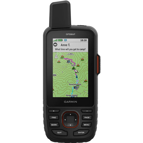
Garmin GPSMAP 67i GPS Handheld Navigator with inReach Satellite Technology
In Stock
SKU #
GAGPSMAP67I
Mfr #
010-02812-00
Manufacturer
Garmin
Description
Navigation and communication in one device: the Garmin GPSMAP 67i GPS Handheld Navigator with inReach Satellite Technology shows you where you're headed and keeps the folks back home posted on your progress. Multiple navigation services combine with preloaded topographical maps and downloadable satellite imagery to show you exactly where you are and what adventures lie ahead. With an active subscription to the Iridium satellite network, you can communicate with others regardless of cell coverage or send an SOS to Garmin Response, the 24/7-staffed emergency response coordination center. You can get crucial weather info from the InReach service or the Garmin Explore phone app, which also makes it easy to plan trips and store routes.The GPSMAP 67i is waterproof, shock resistant, and built for outdoor use. It can run for 165 hours in the default Tracking Mode, saving your location every 10 minutes. NavigationMulti-Band GNSS Services Access multiple global navigation satellite systems (GPS, Galileo and QZSS). Get access to multiple frequencies sent by navigation satellites for improved position accuracy in areas where GNSS signals are reflected, weak, or typically don't penetrate.Built-In Environmental Sensors Navigate every trail with "ABC" sensors, including an altimeter for elevation data, barometer to monitor weather, and 3-axis electronic compass.Topo Maps & Satellite Imagery Download high-resolution, photorealistic maps directly to your device via Wi-Fi technology. Easily find trails, pick stand locations and parking, create waypoints and more. Preloaded TopoActive maps of the U.S., Mexico, and Canada show you terrain contours, topographic elevations, summits, parks, coastlines, rivers, lakes and geographical points. With an Outdoor Maps+ subscription, you get public land information, landowner names, state plat maps, hunting management unit boundaries, BLM boundaries and more.
Product Information
Availability:
In Stock