
- Products
-
Audio & Studio Equipment
See all
-
Cameras & Optics
See all
- Computers & Mobile Devices
- Drones & Aerial Imaging
-
Professional Video & AV
See all
- Security & Surveillance
- TVs & Entertainment
SubcategoriesSee all -
Audio & Studio Equipment
- About us
- Contact Us
- +1-888-219-0753
- Bulk Order

- Products
-
Audio & Studio Equipment
See all
-
Cameras & Optics
See all
- Computers & Mobile Devices
- Drones & Aerial Imaging
-
Professional Video & AV
See all
- Security & Surveillance
- TVs & Entertainment
SubcategoriesSee all -
Audio & Studio Equipment
- About us
- Contact Us
- +1-888-219-0753
- Bulk Order
HomeCatalogDrones & Aerial ImagingMisc. AccessoriesDrone SoftwareDronifi Commercial Real Estate Standard Aerial Imagery Software
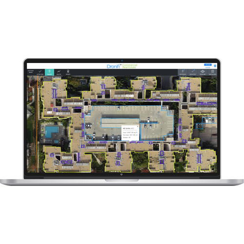
Dronifi Commercial Real Estate Standard Aerial Imagery Software
In Stock
SKU #
DRDCRESTDI3S
Mfr #
STM-DCREST-DI3S
Manufacturer
Dronifi
Description
The Commercial Real Estate Standard Aerial Imagery Software from Dronifi is an end-to-end software solution, allowing you to quickly inspect commercial real estate using any drone or sensor. It also helps with monitoring property upkeep, improving property maintenance, and tracking short- and long-term repairs with the leading image analysis platform. With a limit of up to three sites, 20 flights, and 600 acres, the Commercial Real Estate Software features image stitching that generates maps and orthomosaics to view your property in 2D, 3D, and video. It also features image analysis that reviews automated analysis and creates time lapses to showcase property enhancement. Receive data-driven reports demonstrating flight findings and change over time.None Get a comprehensive view of commercial properties and create updated property mapsNone Create work orders and take action on repairs and improvementsNone Generate summary reports to monitor ongoing renovation projectsNone Compare property snapshots over time and multiple flightsNone Co-brand tools and reporting with your company logo
Product Information
Availability:
In Stock